A recent post from Phil Turner has brought forward a post I had been thinking about for ages. I started to write part of this as a comment and realised it was time to do the actual post.
Sometimes I wonder if I have part-time OCD, I spend hours logging things. Don't get me started about Evernote receipt logging or its uses for walking, thats another future post. Why do I only have part-time OCD, well I often eventually become bored with my anal procedures of recording things and will move to another solution.
When Phil started writing about logging his walks, this immediately peaked my interest. I was hoping he had a magical solution that would be like seeing the pearly gates (hang on isn't that when your dead and I'm an atheist). Anyway on this occassion my delight soon turned into despair as I discovered he was even more useless than me and was also looking for the holy grail (where are these bloody religious ideas coming from tonight).
I will say before you go any further that I haven't found the cup err I mean solution but I have tried a few which I will describe below and they may be perfect for you. Ultimately I am lazy and easily bored and this is why each of these have failed.
Spreadsheet - Very simple and effective for hill bagging and you could use this one, you could even create graphs from the data if you can be bothered (I made a few). I have also tried a custom one in Google Docs which allowed me to update it from anywhere. Ultimately its a lot of work, not very pretty and useless for photos, routes or trip reports.
Database - Again this is almost the same as the spreadsheet and you can get one from the same place. I have created several custom ones over the years. These have all the same problems as the Spreadsheet, except a Database sounds more impressive but isn't!
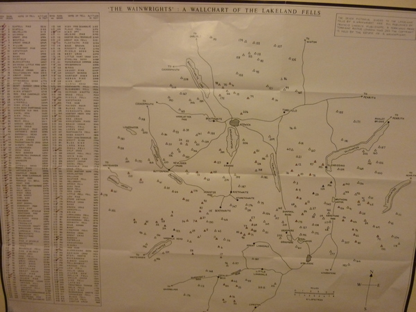 3. Wall Chart - These I do like and I have 3 in my Operations Centre (spare bedroom). They are fantastic to impress your equally sad mates who will like me stare in awe at the mountains. They also allow you to do some colouring. Yet I have only filled in the Wainwright one. I couldn't bring myself to ruin the Harveys Wall charts by filling them in. So they are used to see where mountains are located and to stare longingly at. These are also useless for recording anything but hill bagging.
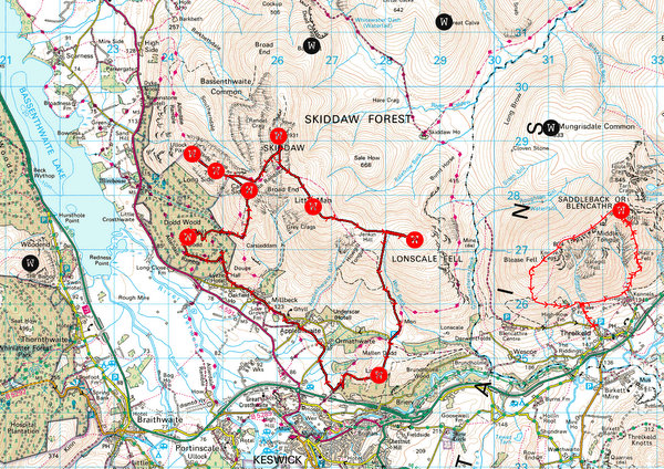
- Memory Map - Now this is more promising and I imagine you can do something similar in the other mapping software. I downloaded the hill locations from v-g years ago, you can also find an even greater list here. With the V-G files I found I could change the colour of symbols for Wainwrights between Black & Red. Red symbolised I'd walked the hill. This is great I like visual stuff like the Wall Chart, except of course Memory Maps main function is for routes. You can create routes or for the purposes of this post, you can import tracks from your GPS. You do have a GPS don't you, you can't have OCD like me and not have a GPS. You need to know how fast you were walking and exactly how long you were stationary on every walk or the world could end. I found you could create a master file that you update the hill colours as you walk them and import each GPS walk track. This quickly creates a file that records the route of every walk and the hills bagged. Special Bonus feature you can add a link to your blog trip report from a waypoint, if you wrote one. This is the best solution so far, but its not ideal as its not easy to share and is still quite a lot of work.
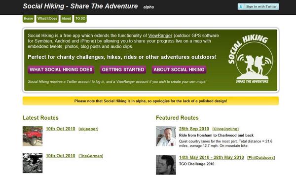
- Social Hiking - This is a new(ish) solution that I have high hopes for. At the moment it isn't ideal for me but could be soon. Social hiking is a mashup created by Phil Sorrell that brings together Viewranger, Twitter, Audio Boo and Twitpic. This allows you in real time to show on a map where you are and have your tweets, audioboos and pictures plotted at the location they were created. This saves loads of time but has got some problems for recording purposes. Obviously you must carry a Viewranger supported phone and produce the items as you go. For geeks like me this is amazing and I did start to code something similar before finding Phil had done a far better job than I ever would. I would explode in excitement if it supported Google Latitude and Picasa Web Albums but if they ever found there way onto Phils todo list they would be a long way down it. This of course relies on you doing things as you go (at the moment?)
 6. Blog - This is how many of us record our trips, writing up reports on our blogs and posting it for the world to see and hopefully (sometimes) enjoy. This is very time consuming, maybe its just me rambling on but it can take me several hours to write up one walk.
Paper based - In among the high tech solutions there is always the low tech. I personally have never kept a hand written journal of my walks. The closest I got to this was buying the 2 Wainwright bagging journal things for a girlfriend so she could write up the walks. I think she recorded about 4 (should of bought a cuben stuff sack instead). My dads walking partner in crime marks every route they walk on paper maps, so they can see every route they have ever walked.
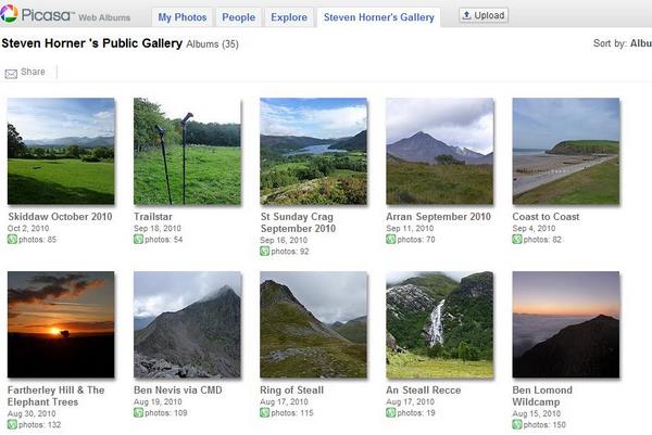
Picasa Web Albums - This is simply a place to put your photos and you can add descriptions along with the location each picture was taken (manually or from Exif). The photos can be added to your blog and shared, this is simple and something I do still use. You could also use Flickr.

Zippymap - Whats that, its a dorment project from the mind of Steven Horner (me) that I started several years ago and almost started to get off the ground after discussions with Jonathan Craddock but then I got side tracked by some other shiny thing. The idea was similar to Social Hiking but initially its focus wasn't on Live blogging but it could easily of been added. I am ultimately lazy and have a million other things I could be doing, so the reason almost all the above failed is because they involved too much work. The Memory map idea sounded like a good one but it wasn't really designed for that purpose, so Zippymap could be an intelligent online version of it. I can hear you say there a loads of similar sites. Yes there are, Everytrail, OutdoorsMagic, etc.. but they didn't really record routes and hills bagged. None were intelligent enough to look at your GPX route and realise you had bagged 5 mountains, ask you to confirm it then automatically update your hill bagging list. Also it could add pictures from Flickr or Picasa using Geotags onto the route, add descriptions/trip reports. There were many other things but you didn't have to use all the features or it would be overwhelming. I'm not sure if I will ever ressurect Zippymap, I've still yet to see anyone implement many of the ideas I had (many not listed above). It would be trip recording heaven (for me anyway). I've added this either in the hope that someone else will do it or that I will decide to actually do it myself (Remember I said I was lazy).
Much like Phils post I have no solution or more accurately no implemented solution. If I listed all the things I've tried the post would be 10 times the length it is, possibly one of the above could be perfect for your needs.
Comments