Once again the blog has been silent for a while, so many things have been going on recently. The biggest single thing is organising my wedding to Traci or rather our Honeymoon walking the John Muir Trail. The wedding itself is very simple with just Traci, myself and the wedding wagon marrying us on the balcony of our Cosmopolitan suite in Las Vegas.
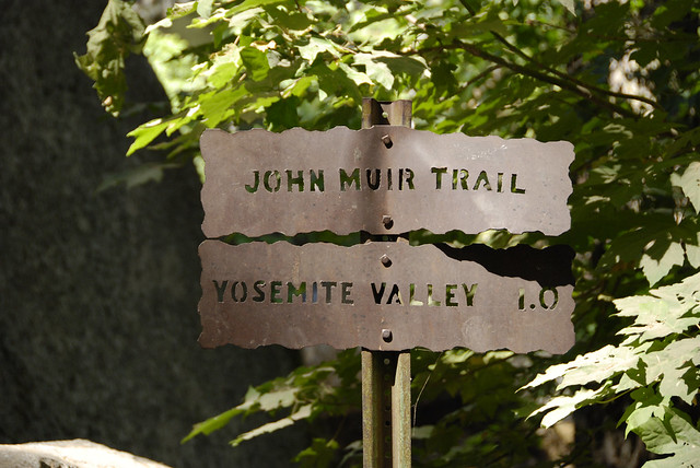
So what's this John Muir Trail then?
For me personally the John Muir Trail came to my attention about 5 years ago from conversations with Phil Turner, I subsequently bought the Cicerone Guide glanced at it then it sat on my shelf unread. I have spent quite a bit of time on and off over the intervening years looking at pictures and stories of those that have walked it. So what is it...
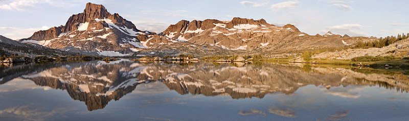
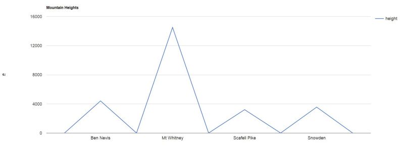
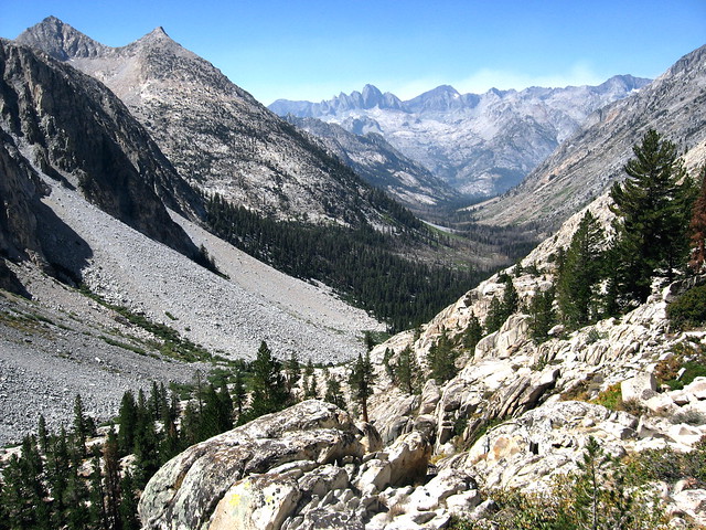
It's a 211 mile walk in the Sierra Nevada mountain range in California, which passes through several national parks (Yosemite, King's Canyon, John Muir and Ansel Adams wildernesses and Sequoia). Usually starting in Yosemite Valley and ending on the summit of Mt Whitney, which is the highest mountain in the contiguous United States (the 48 adjoining states) at 14,505 ft (4,421 m). Nearly all of the route lies over 8,000 ft in elevation and a third at over 10,000 ft. To put this in perspective, the highest mountain in the UK is Ben Nevis at a mere 4,409 ft.
We couldn't acquire permits for the regular south bound route described above, the idea of permits is a strange concept to us UK walkers. In the US it's more common and helps to keep popular routes wild by limiting the numbers of people allowed to walk the trail. I will go into more detail regarding permits in another post, but we managed to secure a permit in the opposite direction (North Bound). The John Muir Trail may end or start in our case on Mt Whitney but unless we could parachute in we need to walk to the summit. The closest starting point (Trail head) is Whitney portal but this is one of the most popular starting points in the US due to Mt Whitneys height. We have to start from a Trail head further South at Horseshoe Meadows, this will add an extra 22 miles to our route.

How long will it take?
Many people take 3 weeks, but after looking at lots of trip reports most of these appear to be a lot slower than we travel or carry huge packs, stop to fish, video the route, etc. So after what feels like months I have a schedule which I think looks realistic. We are aiming to complete the walk in 14 days, we may extend this by a couple of days as there are a couple of long 20+ mile days but these are when our packs are at their lightest and well into the walk. We intend to take it easy at the start to acclimatise to the altitude and the packs will be heavy with 10 days of food. I'm not going to post the actual schedule, it will very likely change as we are walking.
Planning
Planning any walk can feel like a military operation and can be stressful, but when it's abroad for any extended period and you have the added event of a wedding it becomes a lot of work. I'm sure the planning is simple compared to long distance walks like the PCT or CDT.
- Permits
- Food
- Transport
- Accommodation
- Storage (wedding items)
- Insurance?
These have been the biggest headaches, but gradually I hope I have solved all of them. I hope to write some future posts covering some of these before we actually set off and update them once we return but I can't commit 100% to that.
All pictures in this post are copyright Creative Commons to their respected attributed owners.
Comments