This website has been on hold for a while, unfortunately I didn't do a lot of walking in 2014. A few walks locally, the Durham Dales Challenge, Scarborough to Whitby, a couple of walks in the lakes and a trip or two to Scotland. In previous years I would have done this in 1 month. Traci and I have a few things planned for 2015, the biggest of which will be our July wedding in Las Vegas. Our Honeymoon will be walking the John Muir Trail
Steven Horner
Walking Mt Toubkal
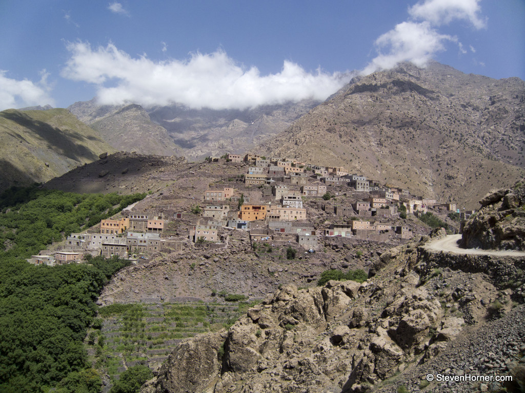
Myself and Traci actually did this walk 18 months ago in June 2013, but for some reason I never got around to writing it up. I made extensive notes on the actual days and this is the write up of those notes. Hopefully someone will find this useful. We were looking for a summer holiday to relax but me being me, I wanted something a bit different. I have always hated sitting around a pool or lazing on a beach. Initially we were looking at Greece
The Most Visible Mountain & New Mountain Classifications
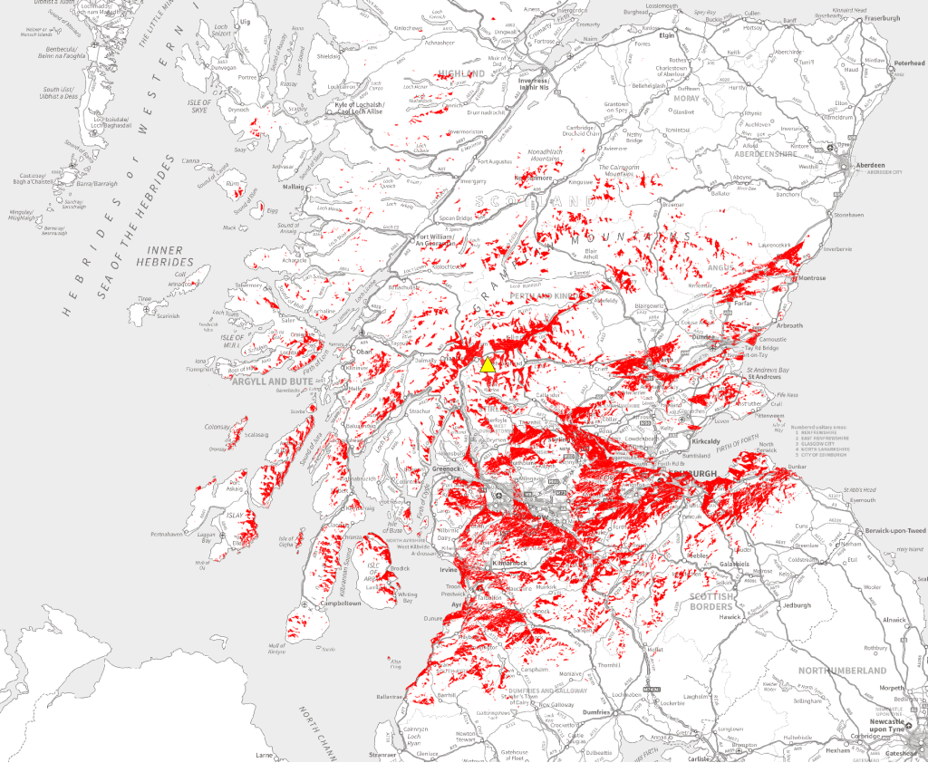
The most successful projects, to me at least, are those where you learn so much more than you ever expected to. I started the Peak Visibility project to find the answer to what seamed like a very simple question "Which Scottish Mountain can you see the most?". You can find out how this question arose in the first Peak Visibility post or at the end of this post. It was not quite as simple as I had thought, the first thing was to define the question
Mountain Leader Training
Over a year ago now I attended a Mountain Leader Summer Training course with the intention of deciding if I would like to guide walks for a living. I had taken many friends and family walking over the years and wanted to know what it would be like to do it for a job. If I decided not to follow that ML path the money (£450) wouldn't be wasted because I knew I would gain new skills which I'm always eager to learn. I originally hoped
The Most Visible Mountain in Scotland
On a recent trip to the West Highlands I pointed out what I believed to be Schiehallion in the distance as we crossed Rannoch Moor in the car. I recalled how I had been told it was the mountain you could see from the most places in Scotland. I decided that I would test if this was really true. I had a feeling it wasn't. How do you do that? Obviously I am not going to stand in every spot in Scotland and work out what